Pedestrian crossing (information sign): road signs in Tashkent

Pedestrian crossing (information sign): road signs in Tashkent — 14 photos with addresses and landmarks

14 photos · all “Road signs”

Road signs “Pedestrian crossing (information sign)” on the map

All 14 with a geotag. Click a point for the photo and description.

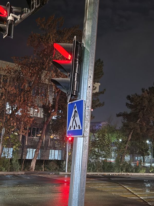
Blue “Pedestrian crossing” sign on a traffic light pole at an intersection, evening; a traffic light showing red next to it

Blue “Pedestrian crossing” sign on a traffic light pole at an intersection, evening; a traffic light showing red next to it

Pedestrian crossing (information sign)
Pedestrian crossing (information sign): Крепление: на столбе светофора
41.353729, 69.38862141°21'13.4"N 69°23'19.0"E
on the map: OSM · Esri · CARTO · Google Maps · Yandex Maps · altitude 456 m
2026-11-17 20:14 · photo page
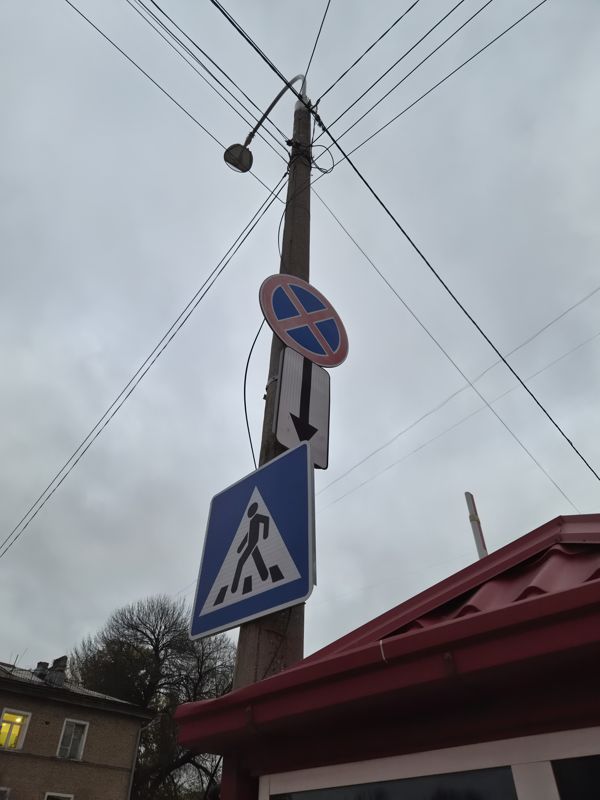
On a concrete lamp post, from bottom to top: a blue “Pedestrian crossing” sign, above it a plate with a downward arrow and a round sign with a red cross “No stopping”; a red kiosk roof nearby

On a concrete lamp post, from bottom to top: a blue “Pedestrian crossing” sign, above it a plate with a downward arrow and a round sign with a red cross “No stopping”; a red kiosk roof nearby

No stoppingPedestrian crossing (information sign)Plate: direction of effect
No stopping: Крепление: на бетонном столбе освещения · Состояние: красная кайма выцвела
Pedestrian crossing (information sign): Крепление: на бетонном столбе освещения
Plate: direction of effect: Надпись: стрелка вниз · Крепление: под знаком «Остановка запрещена» на том же столбе
41.329351, 69.32465741°19'45.7"N 69°19'28.8"E
on the map: OSM · Esri · CARTO · Google Maps · Yandex Maps · altitude 429 m
2026-11-11 17:10 · photo page
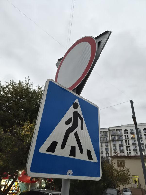
From below, close-up: a blue “Pedestrian crossing” sign and above it a round sign with a red border and an empty white field, “No vehicles”; behind it the gray back of a sign, in the distance a residential building and market stalls

From below, close-up: a blue “Pedestrian crossing” sign and above it a round sign with a red border and an empty white field, “No vehicles”; behind it the gray back of a sign, in the distance a residential building and market stalls

Pedestrian crossing (information sign)No vehicles
Pedestrian crossing (information sign): Крепление: на своей стойке · Состояние: внизу на плёнке отклеившийся уголок наклейки
No vehicles: Крепление: на той же стойке над пешеходным переходом
41.329166, 69.32343241°19'45.0"N 69°19'24.4"E
on the map: OSM · Esri · CARTO · Google Maps · Yandex Maps · altitude 429 m
2026-11-11 17:01 · photo page
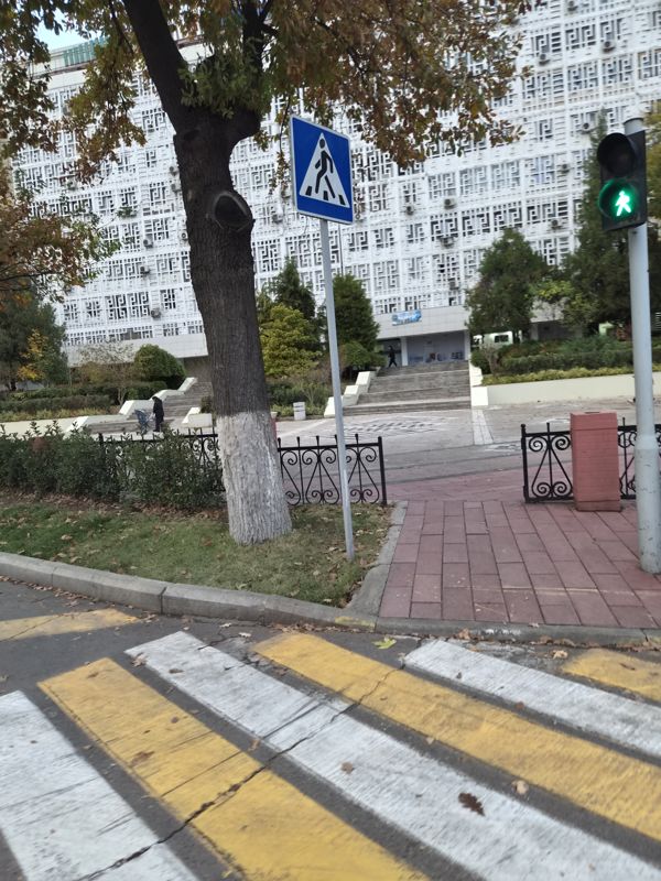
Blue “Pedestrian crossing” sign on a post behind the curb at a zebra crossing, to the right a pedestrian traffic light showing green; in the background a building with a white openwork facade

Blue “Pedestrian crossing” sign on a post behind the curb at a zebra crossing, to the right a pedestrian traffic light showing green; in the background a building with a white openwork facade

Pedestrian crossing (information sign)
Pedestrian crossing (information sign): Где: у наземного пешеходного перехода перед зданием · Крепление: на своей стойке
41.321097, 69.30301741°19'15.9"N 69°18'10.9"E
on the map: OSM · Esri · CARTO · Google Maps · Yandex Maps · altitude 413 m
2026-11-11 16:34 · photo page
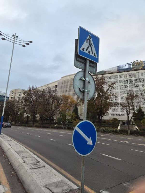
On one post by the roadway, a blue “Pedestrian crossing” sign and below it a blue round sign with a down-right arrow “Obstacle bypass”; between them the back of another round sign; a building with a coat of arms in the background

On one post by the roadway, a blue “Pedestrian crossing” sign and below it a blue round sign with a down-right arrow “Obstacle bypass”; between them the back of another round sign; a building with a coat of arms in the background

Pass the obstaclePedestrian crossing (information sign)
Pass the obstacle: Где: у проспекта напротив здания · Крепление: на своей стойке
Pedestrian crossing (information sign): Где: у проспекта напротив здания · Крепление: на своей стойке
41.320873, 69.30305941°19'15.1"N 69°18'11.0"E
on the map: OSM · Esri · CARTO · Google Maps · Yandex Maps · altitude 417 m
2026-11-11 16:33 · photo page
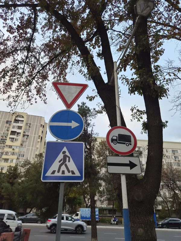
Two posts under a tree: on the left, from top to bottom, “Give way”, “Proceed to the right” and a blue “Pedestrian crossing”; on the right, “No trucks” with a plate with an arrow pointing right; along an avenue

Two posts under a tree: on the left, from top to bottom, “Give way”, “Proceed to the right” and a blue “Pedestrian crossing”; on the right, “No trucks” with a plate with an arrow pointing right; along an avenue

No heavy goods vehiclesPedestrian crossing (information sign)Give wayTurn rightPlate: direction of effect
No heavy goods vehicles: Крепление: на сине-белой стойке
Pedestrian crossing (information sign): Mounting: on its own post
Give way: Mounting: on its own post
Turn right: Mounting: on its own post
Plate: direction of effect: Надпись: стрелка вправо · Крепление: под знаком на той же стойке
41.320318, 69.30156941°19'13.1"N 69°18'05.6"E
on the map: OSM · Esri · CARTO · Google Maps · Yandex Maps · altitude 421 m
2026-11-11 16:31 · photo page
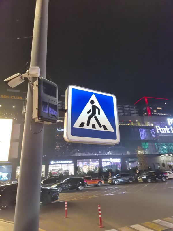
At night on a pole: a lit «Pedestrian crossing» sign (a white triangle with a pedestrian on a blue square) in an illuminated box on a bracket, by a shopping centre

At night on a pole: a lit «Pedestrian crossing» sign (a white triangle with a pedestrian on a blue square) in an illuminated box on a bracket, by a shopping centre

Pedestrian crossing (information sign)
Pedestrian crossing (information sign): Где: у торгового центра, у пешеходного перехода · Крепление: на столбе на кронштейне · Состояние: знак с внутренней подсветкой
41.318066, 69.25126241°19'05.0"N 69°15'04.5"E
on the map: OSM · Esri · CARTO · Google Maps · Yandex Maps · altitude 404 m
2026-11-07 22:00 · photo page
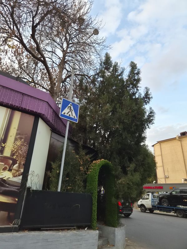
A blue square “Pedestrian crossing” sign on a lamp post by an intersection, a cafe and a tall conifer nearby, evening

A blue square “Pedestrian crossing” sign on a lamp post by an intersection, a cafe and a tall conifer nearby, evening

Pedestrian crossing (information sign)
Pedestrian crossing (information sign): Где: у перекрёстка, рядом с кафе · Крепление: на столбе освещения
41.353609, 69.38824641°21'13.0"N 69°23'17.7"E
on the map: OSM · Esri · CARTO · Google Maps · Yandex Maps · altitude 429 m
2026-11-06 16:54 · photo page
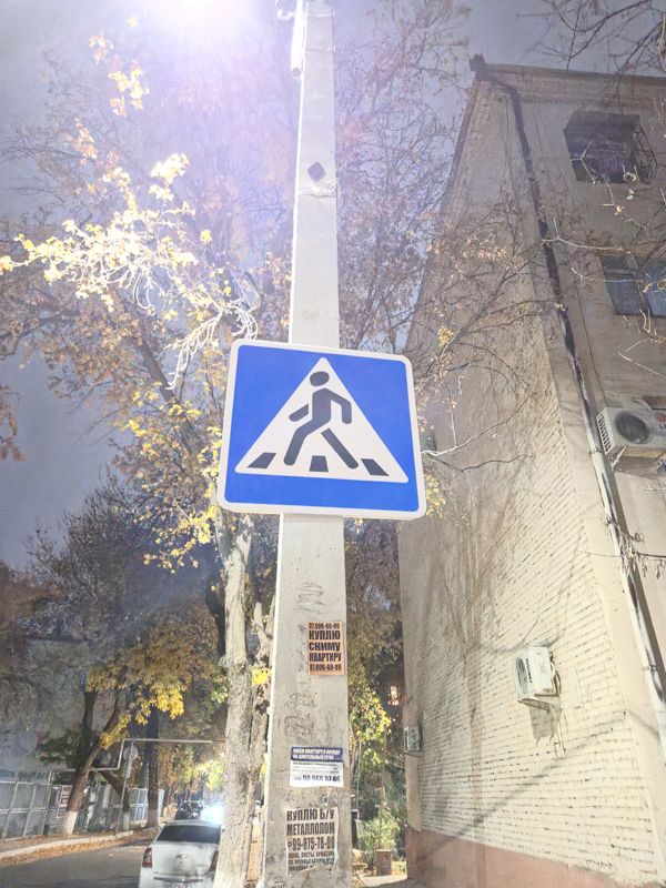
A blue “Pedestrian crossing” sign on a concrete lamp post by a brick house, paper notices low on the post, a camera higher up on the post, night

A blue “Pedestrian crossing” sign on a concrete lamp post by a brick house, paper notices low on the post, a camera higher up on the post, night

Pedestrian crossing (information sign)
Pedestrian crossing (information sign): Where: by a brick residential building · Mounting: on a lamp post
41.349160, 69.34198241°20'57.0"N 69°20'31.1"E
on the map: OSM · Esri · CARTO · Google Maps · Yandex Maps · altitude 450 m
2026-11-04 19:19 · photo page
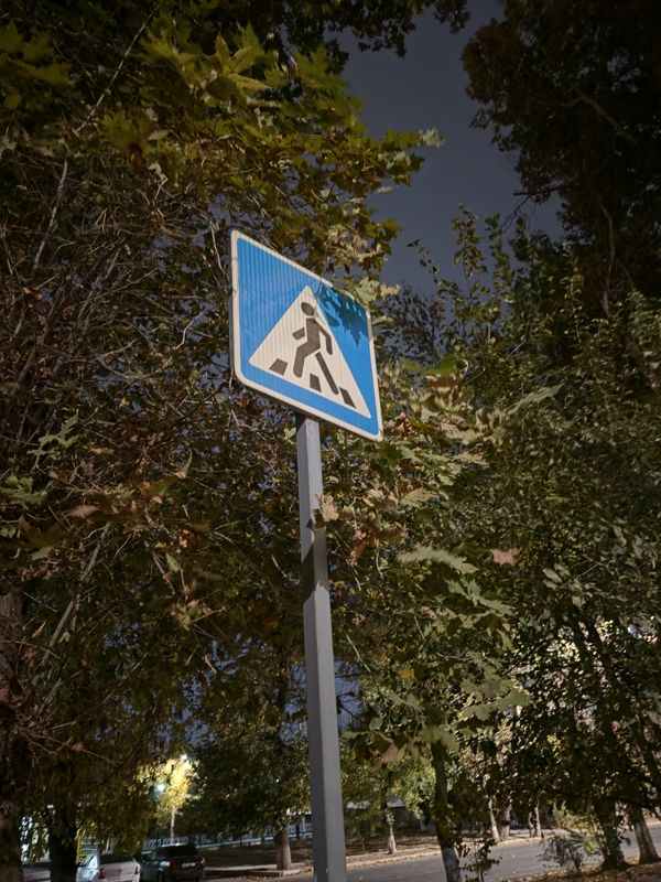
A blue “Pedestrian crossing” sign on a metal post seen from below, partly hidden by plane tree foliage, night

A blue “Pedestrian crossing” sign on a metal post seen from below, partly hidden by plane tree foliage, night

Pedestrian crossing (information sign)
Pedestrian crossing (information sign): Mounting: on a metal post · Condition: partly covered by foliage
41.354327, 69.34043241°21'15.6"N 69°20'25.6"E
on the map: OSM · Esri · CARTO · Google Maps · Yandex Maps · altitude 449 m
2026-11-04 19:05 · photo page
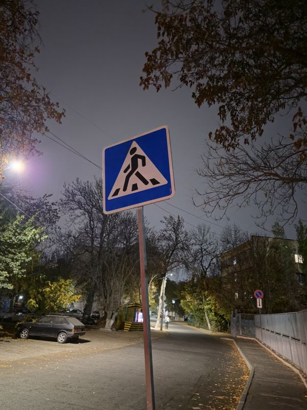
At night, a blue “Pedestrian crossing” sign on a post, the post is tilted, a street with a lamp in the background

At night, a blue “Pedestrian crossing” sign on a post, the post is tilted, a street with a lamp in the background

Pedestrian crossing (information sign)
Pedestrian crossing (information sign): Where: by an intersection in the yards · Mounting: on its own post · Condition: post tilted
41.348990, 69.34262741°20'56.4"N 69°20'33.5"E
on the map: OSM · Esri · CARTO · Google Maps · Yandex Maps · altitude 445 m
2026-11-04 18:43 · photo page
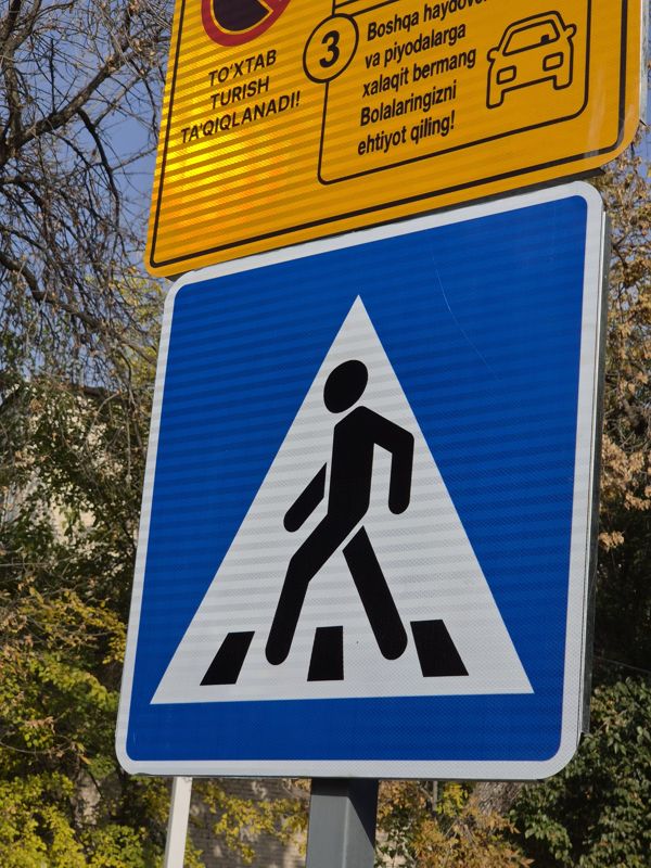
Close-up of a blue “Pedestrian crossing” sign with a yellow plate above it in Uzbek: no parking, “Boshqa haydovchilar va piyodalarga xalaqit bermang. Bolalaringizni ehtiyot qiling!”

Close-up of a blue “Pedestrian crossing” sign with a yellow plate above it in Uzbek: no parking, “Boshqa haydovchilar va piyodalarga xalaqit bermang. Bolalaringizni ehtiyot qiling!”

Other platePedestrian crossing (information sign)
Other plate: Text: To'xtab turish ta'qiqlanadi! / 3. Boshqa haydovchilar va piyodalarga xalaqit bermang. Bolalaringizni ehtiyot qiling! · Mounting: above the sign on the same post
Pedestrian crossing (information sign): Mounting: on its own post · Condition: new, reflective film
41.347598, 69.34147641°20'51.4"N 69°20'29.3"E
on the map: OSM · Esri · CARTO · Google Maps · Yandex Maps · altitude 453 m
2026-11-01 13:22 · photo page
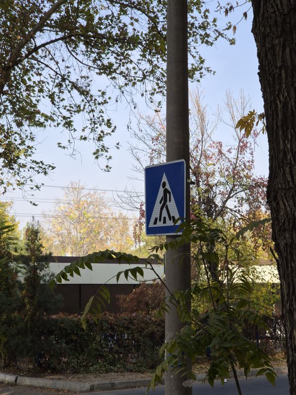
On a concrete pole, a blue “Pedestrian crossing” sign (a white triangle with a pedestrian on a blue rectangle), partly hidden by foliage

On a concrete pole, a blue “Pedestrian crossing” sign (a white triangle with a pedestrian on a blue rectangle), partly hidden by foliage

Pedestrian crossing (information sign)
Pedestrian crossing (information sign): Mounting: on a concrete pole · Condition: the lower corner is hidden by branches
41.354684, 69.34096841°21'16.9"N 69°20'27.5"E
on the map: OSM · Esri · CARTO · Google Maps · Yandex Maps · altitude 443 m
2026-11-01 13:01 · photo page
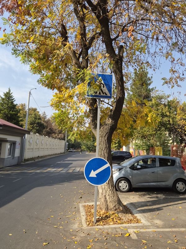
Two signs on one post under a tree: a blue “Pedestrian crossing” on top, a blue round sign with a down-left arrow “Obstacle bypass” below; in a yard by the entrance, autumn

Two signs on one post under a tree: a blue “Pedestrian crossing” on top, a blue round sign with a down-left arrow “Obstacle bypass” below; in a yard by the entrance, autumn

Pass the obstaclePedestrian crossing (information sign)
Pass the obstacle: Where: by a pedestrian crossing at a junction · Mounting: on its own post · Condition: the post leans against a tree trunk
Pedestrian crossing (information sign): Where: by a pedestrian crossing at a junction · Mounting: on its own post · Condition: partly covered by tree branches
41.350721, 69.34847341°21'02.6"N 69°20'54.5"E
on the map: OSM · Esri · CARTO · Google Maps · Yandex Maps · altitude 453 m
2026-11-01 12:47 · photo page
↑