Rivers and canals

Photos of rivers, canals and irrigation ditches: channels, banks, embankments, dams, Tashkent

7 photos Statistics

Objects

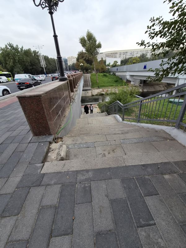
A staircase under the span of a bridge leads to the canal embankment: on the right grey metal railings and a lawn, beyond them the canal and a white bridge with metro “M” signs, on the left a granite parapet and a road with cars, two passers-by on the steps in the distance

A staircase under the span of a bridge leads to the canal embankment: on the right grey metal railings and a lawn, beyond them the canal and a white bridge with metro “M” signs, on the left a granite parapet and a road with cars, two passers-by on the steps in the distance

EmbankmentCanal or irrigation ditch
Embankment: Where: under the bridge, by the roadway · Banks: lawn, concrete cladding · Fencing: grey metal railings · Condition: concrete chipped off at the edge of the parapet
Canal or irrigation ditch: Banks: concrete cladding
41.321006, 69.30572241°19'15.6"N 69°18'20.6"E
on the map: OSM · Esri · CARTO · Google Maps · Yandex Maps · altitude 404 m
2026-10-12 16:45 · photo page
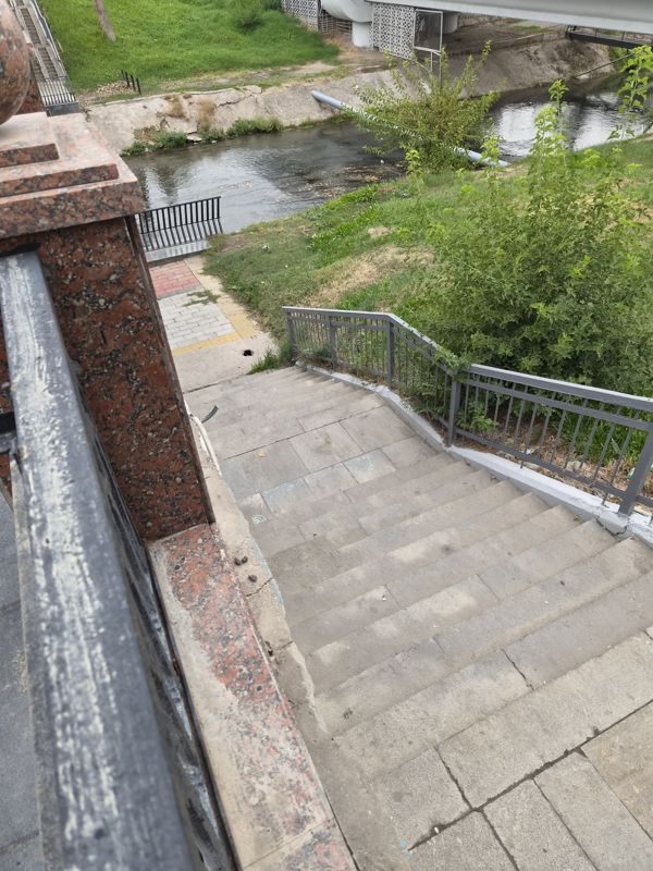
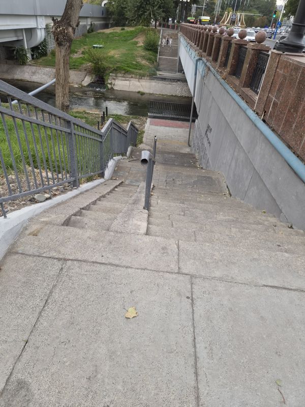
A staircase with grey metal railings descends to the path along the canal: below paving tiles with a yellow tactile strip and a black grille by the water, then a lawn, the canal and the span of a white bridge

A staircase with grey metal railings descends to the path along the canal: below paving tiles with a yellow tactile strip and a black grille by the water, then a lawn, the canal and the span of a white bridge

Canal or irrigation ditchEmbankment
Canal or irrigation ditch: Banks: concrete cladding, lawn · Water: dark, with a current
Embankment: Где: у моста, дорожка вдоль воды · Берега: газон, бетонная облицовка · Ограждение: серые металлические перила, чёрная решётка у воды
41.321006, 69.30572241°19'15.6"N 69°18'20.6"E
on the map: OSM · Esri · CARTO · Google Maps · Yandex Maps · altitude 404 m
2026-10-12 16:45 · photo page
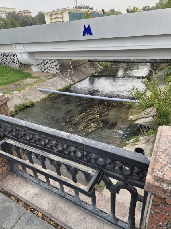
A canal with concrete slopes, seen through the cast-iron grille of a bridge: under a white bridge the water flows to an outlet on the right with a grille and foam, a grey-blue pipe across the channel, shrubs on the right bank

A canal with concrete slopes, seen through the cast-iron grille of a bridge: under a white bridge the water flows to an outlet on the right with a grille and foam, a grey-blue pipe across the channel, shrubs on the right bank

Canal or irrigation ditch
Canal or irrigation ditch: Where: under the bridge · Banks: concrete slopes, shrubs on the right · Water: dark, with a current, foam by the outfall on the right, leaves on the water · Condition: a pipe across the channel
41.321014, 69.30557341°19'15.7"N 69°18'20.1"E
on the map: OSM · Esri · CARTO · Google Maps · Yandex Maps · altitude 407 m
2026-10-12 16:44 · photo page
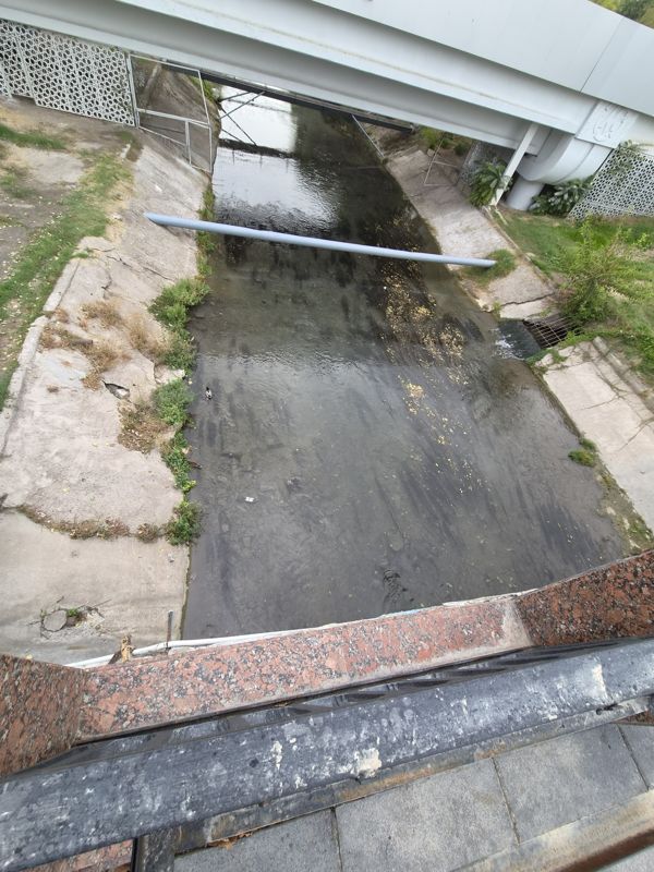
A top view of a concrete canal: water with yellow leaves and small ripples, slopes with cracks and tufts of grass, a grey-blue pipe across the channel, a duck near the left bank; at the top a span of a white bridge with openwork panels, at the bottom a granite parapet

A top view of a concrete canal: water with yellow leaves and small ripples, slopes with cracks and tufts of grass, a grey-blue pipe across the channel, a duck near the left bank; at the top a span of a white bridge with openwork panels, at the bottom a granite parapet

Canal or irrigation ditch
Canal or irrigation ditch: Where: under the bridge · Banks: concrete slabs with cracks, grass · Water: clear, small ripples, yellow leaves on the water · On the water: a duck near the left bank · Condition: a pipe across the channel, litter by the bank
41.321004, 69.30532441°19'15.6"N 69°18'19.2"E
on the map: OSM · Esri · CARTO · Google Maps · Yandex Maps · altitude 404 m
2026-10-12 16:44 · photo page
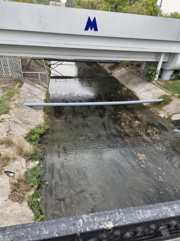
A canal with concrete slopes and clear water, seen from a bridge above: leaves and stones on the bottom, a grey-blue pipe across the channel, a duck near the left bank, the span of a white bridge with a metro “M” sign above

A canal with concrete slopes and clear water, seen from a bridge above: leaves and stones on the bottom, a grey-blue pipe across the channel, a duck near the left bank, the span of a white bridge with a metro “M” sign above

Canal or irrigation ditch
Canal or irrigation ditch: Where: under the bridge · Banks: concrete slabs, cracks in places, grass · Water: clear, calm current, leaves on the bottom · Fencing: openwork panels and mesh gates by the bridge piers · On the water: a duck near the bank · Condition: a pipe laid across the channel
41.321004, 69.30532441°19'15.6"N 69°18'19.2"E
on the map: OSM · Esri · CARTO · Google Maps · Yandex Maps · altitude 404 m
2026-10-12 16:44 · photo page
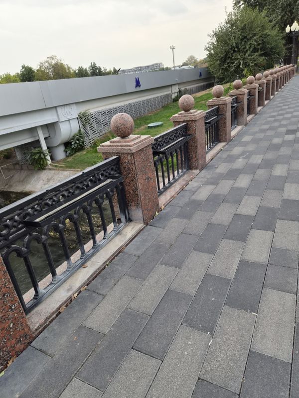
A path along the granite parapet of a bridge: below on the left a canal with dark water and a concrete slope, beyond it the span of a white bridge with metro “M” signs; trees and a lamp on the right, two passers-by in the distance

A path along the granite parapet of a bridge: below on the left a canal with dark water and a concrete slope, beyond it the span of a white bridge with metro “M” signs; trees and a lamp on the right, two passers-by in the distance

Canal or irrigation ditch
Canal or irrigation ditch: Banks: concrete slope, lawn · Water: dark
41.321004, 69.30532441°19'15.6"N 69°18'19.2"E
on the map: OSM · Esri · CARTO · Google Maps · Yandex Maps · altitude 404 m
2026-10-12 16:44 · photo page
A granite staircase with metal handrails descends from a bridge to the canal embankment; at the top left a canal with concrete banks and water under the span of a bridge, a lawn and trees around, three passers-by on the steps in the distance

A granite staircase with metal handrails descends from a bridge to the canal embankment; at the top left a canal with concrete banks and water under the span of a bridge, a lawn and trees around, three passers-by on the steps in the distance

EmbankmentCanal or irrigation ditch
Embankment: Where: by the bridge, a descent to the water · Banks: lawn, concrete cladding · Fencing: grey metal railings
Canal or irrigation ditch: Banks: concrete cladding · Water: dark, calm current
41.321218, 69.30441841°19'16.4"N 69°18'15.9"E
on the map: OSM · Esri · CARTO · Google Maps · Yandex Maps · altitude 406 m
2026-10-12 16:44 · photo page
↑