Pass the obstacle: road signs in Tashkent

Pass the obstacle: road signs in Tashkent — 2 photos with addresses and landmarks

2 photos · all “Road signs”

Road signs “Pass the obstacle” on the map

All 2 with a geotag. Click a point for the photo and description.

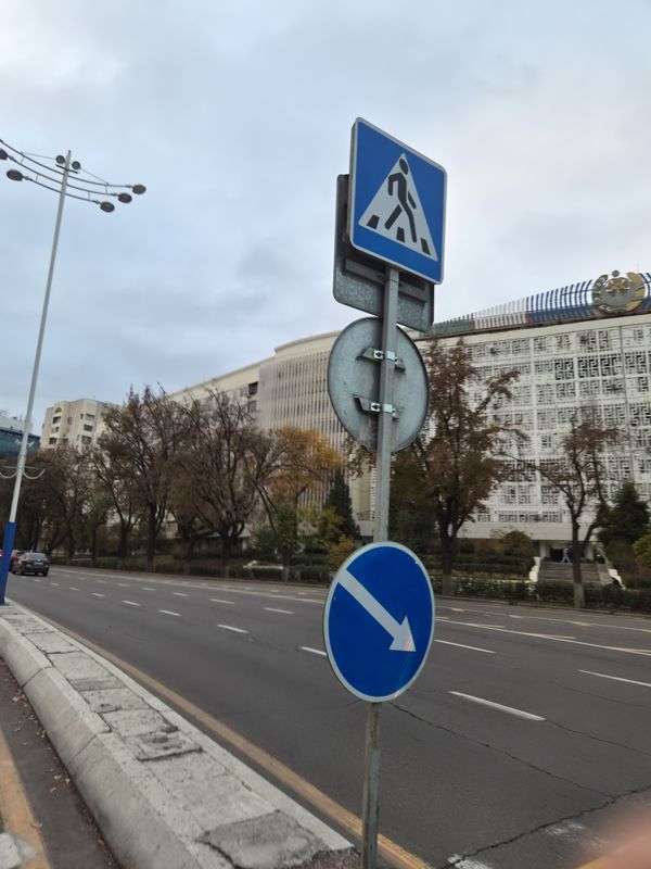
On one post by the roadway, a blue “Pedestrian crossing” sign and below it a blue round sign with a down-right arrow “Obstacle bypass”; between them the back of another round sign; a building with a coat of arms in the background

On one post by the roadway, a blue “Pedestrian crossing” sign and below it a blue round sign with a down-right arrow “Obstacle bypass”; between them the back of another round sign; a building with a coat of arms in the background

Pass the obstaclePedestrian crossing (information sign)
Pass the obstacle: Где: у проспекта напротив здания · Крепление: на своей стойке
Pedestrian crossing (information sign): Где: у проспекта напротив здания · Крепление: на своей стойке
41.320873, 69.30305941°19'15.1"N 69°18'11.0"E
on the map: OSM · Esri · CARTO · Google Maps · Yandex Maps · altitude 417 m
2026-11-11 16:33 · photo page
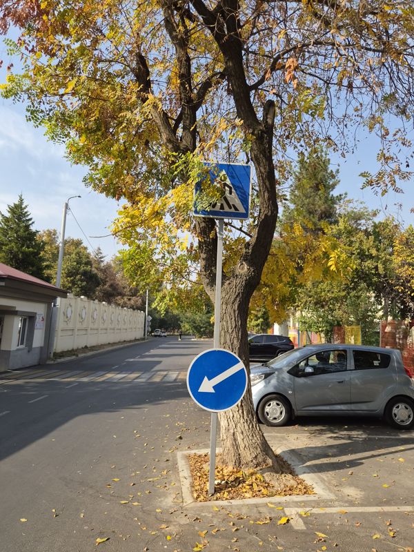
Two signs on one post under a tree: a blue “Pedestrian crossing” on top, a blue round sign with a down-left arrow “Obstacle bypass” below; in a yard by the entrance, autumn

Two signs on one post under a tree: a blue “Pedestrian crossing” on top, a blue round sign with a down-left arrow “Obstacle bypass” below; in a yard by the entrance, autumn

Pass the obstaclePedestrian crossing (information sign)
Pass the obstacle: Where: by a pedestrian crossing at a junction · Mounting: on its own post · Condition: the post leans against a tree trunk
Pedestrian crossing (information sign): Where: by a pedestrian crossing at a junction · Mounting: on its own post · Condition: partly covered by tree branches
41.350721, 69.34847341°21'02.6"N 69°20'54.5"E
on the map: OSM · Esri · CARTO · Google Maps · Yandex Maps · altitude 453 m
2026-11-01 12:47 · photo page
↑