Uzinkass: ATMs in Tashkent

Uzinkas: ATMs in Tashkent — 3 photos with addresses and landmarks

3 photos · Uzinkass: network page · all “ATMs and payment terminals”

“Uzinkass” ATMs on the map

All 3 with a geotag. Click a point for the photo and description.

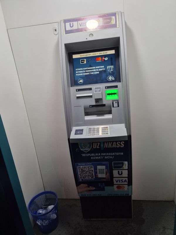
Uzinkass (“Respublika inkassatsiya xizmati” MChJ) ATM in a white cabin: on the screen a prompt to insert a card, contactless reader, barcode reader; a trash bin nearby

Uzinkass (“Respublika inkassatsiya xizmati” MChJ) ATM in a white cabin: on the screen a prompt to insert a card, contactless reader, barcode reader; a trash bin nearby

Uzinkas
Uzinkas: Location: white cabin · Cards: Uzcard, Humo, Visa, Mastercard, UnionPay · Contactless: yes
Landmark: Chorsu Bazaar
Also nearby: InfinBANK · Apexbank
41.327251, 69.23411741°19'38.1"N 69°14'02.8"E
on the map: OSM · Esri · CARTO · Google Maps · Yandex Maps · altitude 402 m
2026-10-26 17:58 · photo page
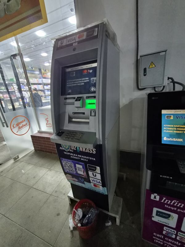
Uzinkass ATM (“Respublika inkassatsiya xizmati” MChJ) at the entrance of “Syrnaya Lavka”; on the right a second InfinBANK ATM, an electrical panel on the wall

Uzinkass ATM (“Respublika inkassatsiya xizmati” MChJ) at the entrance of “Syrnaya Lavka”; on the right a second InfinBANK ATM, an electrical panel on the wall

InfinBANKUzinkas
Uzinkas: Location: at the entrance to the “Syrnaya Lavka” cheese shop
Also nearby: Kapitalbank ≈ 10 m · Paynet ≈ 20 m · Garant Bank ≈ 20 m · Xalq Banki ≈ 20 m · Tenge Bank ≈ 20 m
41.354653, 69.38611041°21'16.7"N 69°23'10.0"E
on the map: OSM · Esri · CARTO · Google Maps · Yandex Maps · altitude 460 m
2026-10-08 18:03 · photo page
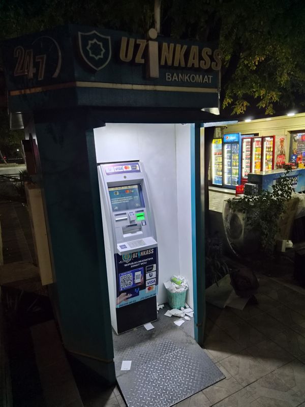
At night: a street Uzinkass (“Respublika inkassatsiya xizmati” MChJ) ATM in a booth with a 24/7 sign; the screen shows a prompt to insert a card, a kiosk with fridges nearby

At night: a street Uzinkass (“Respublika inkassatsiya xizmati” MChJ) ATM in a booth with a 24/7 sign; the screen shows a prompt to insert a card, a kiosk with fridges nearby

Uzinkas
Uzinkas: Location: street booth next to a kiosk · Opening hours: 24/7
Landmark: Bek Pharm Trend pharmacy, TTZ, ≈ 50 m
Also nearby: Asia Alliance Bank ≈ 10 m
41.359104, 69.38823641°21'32.8"N 69°23'17.6"E
on the map: OSM · Esri · CARTO · Google Maps · Yandex Maps · altitude 463 m
2026-10-07 18:31 · photo page
↑